Introduction
We tend to forget that we cannot survive without water, especially when it is available in abundance. Today, across India there is unrestrained wastage, ground water is receding, rivers are polluted with sewage, industrial waste, unburnt/ half burnt corpses, amongst others. 80 percent of the waters of the western rivers have already been lost to Pakistan, through the Indus Water Treaty. The way things stand, we are disregarding the value of water by not giving due importance to its conservation, preservation, and storage.
On the other hand, 70 years ago China foresaw how the water crisis was likely to affect their country. This could well have been one of the reasons for them to occupy Tibet, because that is where all the water was. China sees itself as an upstream controller of South Asia’s mightiest rivers. It is estimated that 718 billion cubic meters (BCM) of surface water flows out of the Tibetan Plateau.
How differently India and China are addressing the water issue is discussed below.
Tibet
Tibet has a unique triple role as South Asia’s water repository, water supplier, and rainmaker. It is from here that water flows in all directions and into many countries. For South Asia it can be said that Tibet is water and water is Tibet.
Stretching 2,400 Km from West to East, and 1,448 Km from North to South, this unique water bank is on the world’s largest and highest plateau, with the average elevation of 4,000 meters above sea level, aptly called “the Roof of the World.”
The Tibetan Plateau is called the “Third Pole” because it has the largest perennial ice mass on the planet after the Arctic and Antarctica. While the water in the polar icecaps is all locked up, much of the water in Tibet is accessible.
The main rivers flowing out of the Tibetan Plateau include the Yangtze, the Yellow, the Mekong, the Salween, the Irrawaddy, the Arun, the Yarlung Tsanpo (Brahmaputra), the Sutlej, and the Indus. The mighty Ganga`s main tributaries flow in from the Tibet, including Karnali, Gandak, and Kosi.
There are more than 18,000 glaciers in the Great Himalayas, where a zone of permanent rock and ice begins at about 5,500 meters. The glaciers, spread over 42,946 Sq Km, cover 17 percent of the Himalayas. The glaciers serve as massive storehouses of freshwater.
There are more than 1,500 lakes, many located at an altitude of 4,000 to 5,000 meters. The lakes include Mansarovar, Nam Tso, Yamdrok Yumtso, and the largest of all, Ngonpo Tso.
When China annexed Tibet, little of the river waters were being consumed on the plateau itself. This meant that nearly all the water was transferred to downstream basins including India, Nepal, China, Bangladesh, Pakistan, Bhutan, Vietnam, Burma, Cambodia, Laos, and Thailand. Now, with the river waters increasingly being diverted for other economic activities on the plateau and with China pursuing inter-river and inter-basin transfer projects, the transboundary implications of China’s hold over Tibet are becoming worrisome.
Control over Water
 China is the greatest dam builder in the world. Over the last seven decades, the People’s Republic of China has constructed more than 87,000 dams. These projects have led to the displacement of over 23 million people. Such ambitious plans are fructifying due to the system of governance in China, as well as leadership, where successors have continued with policies of predecessors. Mao Zedong approved and supported the idea of large-scale damming of rivers. President Hu Jintao, graduated as an engineer with a major in hydropower. In 1964, he served as Tibet’s martial-law administrator. He thus fused two key elements, Water and Tibet. Premier Wen Jiabao, a geological engineer, had also done geological work in the Tibetan Plateau. He too focused on Tibet’s water. China considers water a sovereign resource rather than a shared resource. Such an approach is bound to have an adverse effect on lower riparian states. China treats data about water flow and hydropower operations as a state secret. Chinese maintains: Not one drop of China’s water should be shared without China using it first or without making those downstream pay for it. China has not signed any international treaty for most of its forty trans-boundary rivers.
 China has dammed every major river on the Tibetan Plateau, Mekong, Salween, Yarlung Tsanpo, Yangtze, Yellow, Indus, Sutlej, Shweli and Karnali. Eight more dams are proposed in the upper-middle reaches of the Yarlung Tsanpo to be built within the next 10 years. There are indications that these dams will have reservoirs to export electricity to mainland China. Zangmo, Gyatsa, and Dagu are three more dams planned on the main Yarlung Tsanpo River.
A Mega Dam has been listed in China’s latest five-year plan. This super hydropower station will be constructed in Medog, on the Great Bend, 30 km from the Indian border. The dam, will generate, 38 gigawatts of power, or more than twice the capacity of the Three Gorges Dam.
These projects are located very close to the geological fault line where the Indian Plate collides with the Eurasian Plate. An adverse natural event causing major damage to Tibet’s dams could lead to floods downstream in India. China has never officially communicated about the construction of these dams on the Brahmaputra. A lack of transparency about dam building on the Tibetan River raises questions about the risk and impact on a river system that supports millions.
The Indian Context
In the Indian context, there are two main river systems that draw their waters from Tibet, the Indus River System, and the Brahmaputra River System.
 The Indus River originates from Mount Kailash/Lake Mapam, enters India through Ladakh and flows into POK. The Sutlej River, which is the longest tributary of the Indus River System, also originates at Mount Kailash/Lake Mansarovar. The Sutlej enters India through Himachal Pradesh.
The hydropower potential of the Sutlej basin is estimated to be 19,988 MW. Out of 190 schemes identified, 18 schemes with a total installed capacity of 3,517 MW are in operation and 14 schemes with a total installed capacity of 5,626 MW are in various stages of completion. These 32 schemes account for 28% of the assessed potential of the basin.
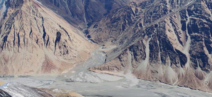
The Yarlung Tsanpo (Brahmaputra) also originates from Mount Kailash. It flows eastward in Tibet at an average altitude of more than 4,000 meters for over 1650 kilometers. Among the world’s major streams, this is the highest river and one of the fastest flowing. It ranks as the fourth-largest river in the world by discharge. The Brahmaputra is by far the most important river flowing from China into any other country in terms of the sheer volume. The average annual transboundary flows into India of the Brahmaputra (165.4 BCM) is greater than the combined cross-border flows of the Mekong and the Salween. The Brahmaputra enters India at Korbo on the McMahon Line as the Siang River in
Arunachal Pradesh. Just before entering India, the Brahmaputra makes a U-shaped turn to form the Great Bend. It cuts through Mount Namcha Barwa and Mount Gyala Peri. Here the river forms the steepest and longest canyon in the world.
The Siang (or Dihang, as it is sometimes referred to) flows about 400 kilometers through a picturesque canyon before it meets with the Dibang River and the Lohit River in the plains of Assam at Kobo, South of Sadiya town. It is from this point, which is the confluence of three rivers, that the river assumes the name Brahmaputra. The river traverses another 650 Km before entering Bangladesh.
The Brahmaputra system contains more than 30% of the country’s water resources. It also has about 40% of India’s total hydropower potential (31,012 MW), although only 3% of the potential has been tapped so far.
Therefore, while China is making maximum use of its waters, it is evident that the existing use in India of both river systems is below the optimal level, while the potential is colossal.
The Mega Dam
China plans to dam the Yarlung Tsangpo, near the Great Bend in Pemako area. After flowing due East from its origin in Kailash Mansarovar, the Yarlung Tsangpo takes an abrupt Southern turn towards India cutting through a very narrow and deep gorge between Namcha Barwa Peak (altitude 25445 ft.) and Gyala Pheri Peak (altitude 23460 ft.). The Great Bend was chosen because of the steep descent of the Yarlung Tsangpo from 10000 ft to 3000 ft, a crucial factor for a hydro-electric dam. It will be the largest dam in human history. It is not clear if the dam is merely a run of the river hydro-power project, and/or part of the South-North water diversion project. With the walls of the gorge 5000 meters and above, it is hard to imagine the amount of water that will get harnessed in the catchment of the dam.
 This gigantic hydropower project will undoubtedly have effect on the quantity of water flow in the Siang (Brahmaputra), especially if it can be controlled. It is also a fact that the Siang is not the only water supplier to the Assam plains, the Siang receives most of its water supply from massive rains in the catchment areas of its tributaries, mainly from Lohit and Subansari rivers.
Untimely release of Brahmaputra waters by China could unleash havoc in Assam. The Brahmaputra’s channel is the widest water channel in India, extending more than 10 Km at certain places. Geographically Arunachal Pradesh rests on the Brahmaputra towards the South. One can cross over from Assam to Arunachal Pradesh only over existing bridges. What if sudden release of water increases the Brahmaputra water channel to 15-20 Km. With air providing a limited link, such an eventuality may result in partial severance of Arunachal Pradesh from the rest of India. Thus, we can again foresee water being used as a weapon of war, as without reinforcements and military supplies, our formations on the inhospitable heights of Arunachal Pradesh could become vulnerable to surprise Chinese aggression.
There is no doubt that the Project is also dangerous from an environmental point of view. Deforestation will lead to rapid soil erosion and landslides. The Brahmaputra, gathers extremely rich silt, which provides essential nutrients for the soil and farming downstream. High silt loads are essential to maintain the agricultural soil fertility and marine life downstream. It is the quality and not only the quantity that is in question.
 However, the concern is not only for damming of rivers, it is also for water diversions, part of the South-North Diversion Project. Will India be greatly deprived of water in case the waters of Tibet are diverted?
The Himalayan region is earthquake prone. Other dams apart, the 38-gigawatt dam at the Great Bend will be huge. If an earthquake strikes and waters of the dam are released, it is obvious who will bear the brunt.
Having said as much, let us look at some recent episodes which should set our minds thinking.
Examples of Deliberate Flooding
At 1.30 am on 1 August 2000, a 50-ft high wall of water tore from Pari Chu into Sutlej River from Khab on the border of Himachal Pradesh & Tibet. The mountain gorges of Kinnaur, Shimla and Mandi Districts in Himachal Pradesh washed away everything that came in its path. By 05.15 am, the water reached Nathpa Jhakri Project. Within a short time, the level of river Sutlej rose by 15 metres. More than 100 persons lost their lives, 120 km of the strategic Old India-Tibet Highway was washed away and 98 bridges of various sizes and shapes were destroyed.
Again in 2004, a lake began to form in the Pari Chu, threatening to cause floods in India’s Sutlej Valley. While China remained cooperative and shared upstream data with India this time, there was speculation that China deliberately created a ‘liquid bomb,’ an artificial lake, to be unleashed at will to potentially devastate downstream areas. This possibility got credence as China rejected a request by India to send scientists and engineers to the site.
In another case, on 11 June 2004 the Siang River rose by an unprecedented 100-120 ft and devastated four districts of Arunachal Pradesh and Assam. More than 26 persons lost their lives while three strategic bridges were swept away by the raging river waters. The official estimate of the loss was around Rs 140 crore.
 The Indian Space Research Organisation had credible evidence that the Chinese caused these flash floods. Satellite images showed massive water bodies or lakes upstream in Sutlej and Siang River basins before the flash floods took place. These lakes disappeared soon after the disaster struck Indian territory.
The Brahmaputra, on 1 March 2012, ran completely dry at a place called Pasighat in Arunachal Pradesh. This was unprecedented. After a few hours, the Brahmaputra began filling up with high columns of onrushing water which inundated Pasighat town. This incidence raises the possibility of blocking water at upper reaches first, and suddenly releasing it thereafter.
In 2017, the Siang River turned muddy and blackened, raising concerns about China’s upstream activities. With up to ten inches of sediment accumulated on some stretches of the riverbed, the water became unfit for human consumption.
Conclusion
India is a downstream country and thus is vulnerable to a fear of an upper riparian tinkering with catchment waters. Such releases of water in a war like situation could have major military implications. Since China has effectively dammed every river that flows into India, it can use water as a weapon of war, by controlling releases as part of a military strategy. This water narrative sows the seed of mistrust among neighbours.
My understanding, however farfetched it may sound, is that these sudden releases of water from various rivers were intentional and not an act of God. Water, too much or too little, can create crisis situations. If employed as part of a military strategy it can lead to unimaginable repercussions.
I wish to place on record my special thanks to Professor Brahma Chellaney under whose inspiration and guidance I began research on this subject over a decade ago.
ABOUT THE AUTHOR
 Major General VK Singh was commissioned into The Scinde Horse in December 1983. He has the distinction of being the first Armoured Corps Officer to command an Assam Rifles Battalion in CI Operations. He is also the first General Cadre officer to command a Strategic Forces Brigade. Later he commanded 12 Infantry Division. An alumnus of St Columba’s School, and St Stephens College, the General is a fourth-generation army officer.